Here are some photos from several rides in northeastern Franklin County, Kansas, visiting historic and scenic sites:
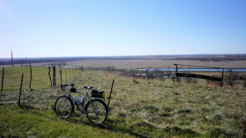 This is called “Pork Chop Hill” (known as “Shawnee Mound” during the nineteenth century).
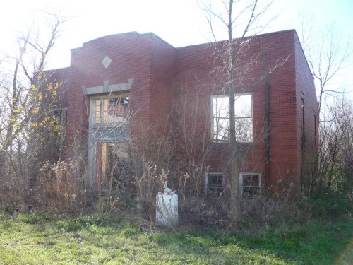 This is an old school building in LeLoup, Kansas, built in 1916. LeLoup (“wolf” in French) is nearly a ghost town, with only a few, mostly dilapidated, houses left. The town prospered in the early 1900’s and was once the home of the Modern Woodmen of America Association picnic, an annual summer event where families gathered for games, contests and picnics in the grove by Wolf Creek.
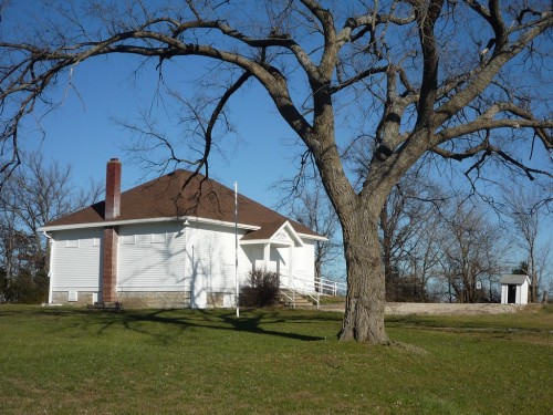 Brown School is an old country schoolhouse, now used as a community building.
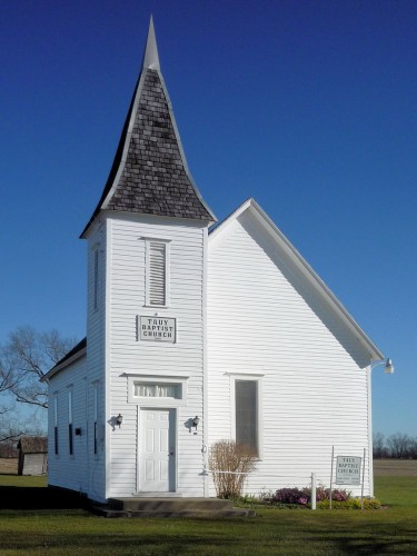 Tauy Creek Baptist Church was organized in 1897, meeting first at Brown School until the church was built in 1900. Alfred F. Richmond, a boy of 11 in 1863, witnessed the escape of William Clarke Quantrill’s raiders from Lawrence and their pursuit by U.S. Cavalry under the command of Preston Plumb in the area where the church now stands.
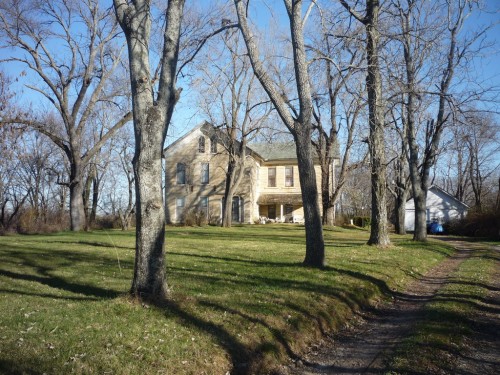 In 1843 a trading post was located at the ford of Tauy Creek later called “Rock Bottom” to serve travelers on the Fort Scott Road. John Tecumseh Jones, an educated half-blood Chippewa and former interpreter for the Pottawatomies, joined the Ottawa tribe and was later adopted by them. He became their leader, their minister and their storekeeper, besides operating the only hotel in the county, on this site. Jones became known as “Ottaway’ or “Tauy” Jones because of his position with the tribe. The creek’s nickname of Tauy also refers to the Ottawas. The first house of logs was burned by pro-slavers in 1856 who came seeking to kill Tauy Jones who escaped. In 1867 he completed this sandstone house with stone quarried near Ft. Scott and freighted here by wagon. Although Jones was a friend of John Brown, who frequently camped in the grove across the creek, rumors that the house’s cellar served as a station on the underground railway are unsubstantiated. Horace Greeley did visit the Jones’, but Abraham Lincoln never got this far south during his presidential campaign in 1859. The home is listed on the national Register of Historic Places.
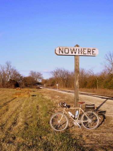 Nowhere, KS was originally a stop on the Leavenworth, Lawrence and Fort Gibson railroad, and today the Midland Railway runs on these tracks. This sign is all that’s left of the town.
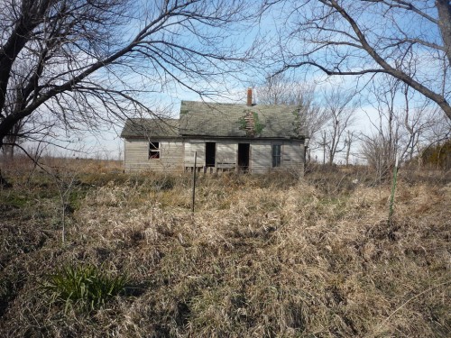 This abandoned house is located just southeast of Wellsville, KS.
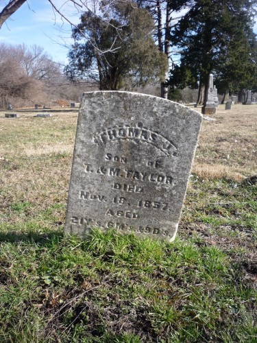 Peoria Cemetery is located near Peoria, Kansas. The cemetery was established in 1857 for the burial of John Taylor, 21. John had preceded his family to Kansas and had settled on land here. John was on the south side of the river when he got word that his family had arrived. He swam through the cold water to greet them and later died of pneumonia from the chill. The parents gave a portion of this land for the cemetery. This is Taylor’s marker, and his parent’s stone is located nearby.
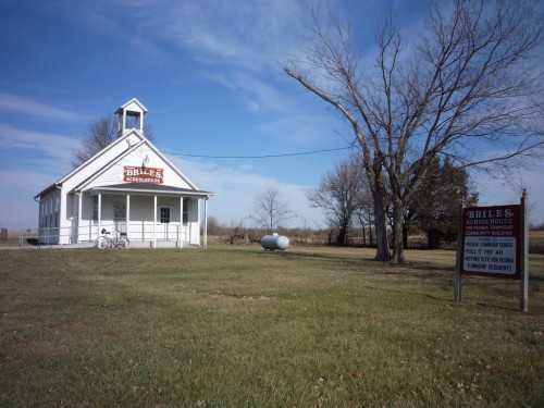 Briles Schoolhouse – Built in 1868 and closed In 1960, the school is now a community center, Through the efforts of the Full O’ Pep 4-H, the State Highway Dept. paid to have the school moved in lieu of paying for the right-of-way when K-68 Highway was widened in 1980.
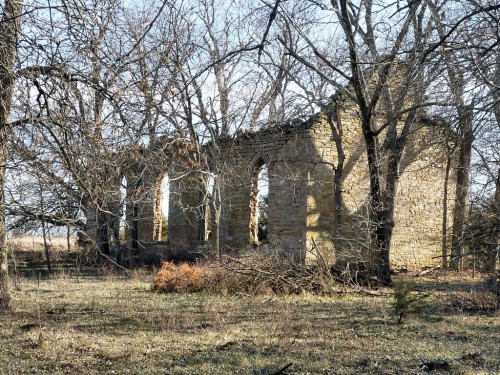 This stone building was an independent church known as Center Chapel, built around the turn of the century by the men of the community. It is located just northeast of Ottawa, Kansas.
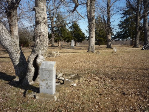 The Ottawa Baptist Indian Mission was the home of the first printing press in Kansas Territory, used to produce Indian language hymnals, prayer books and laws for the Shawnees and the Ottawas. The cemetery here contains Reverend Jotham Meeker, who founded the mission, John T. “Tauy’ Jones (mentioned earlier), Ottawa chiefs Notino and Compchau (shown here), plus many more.
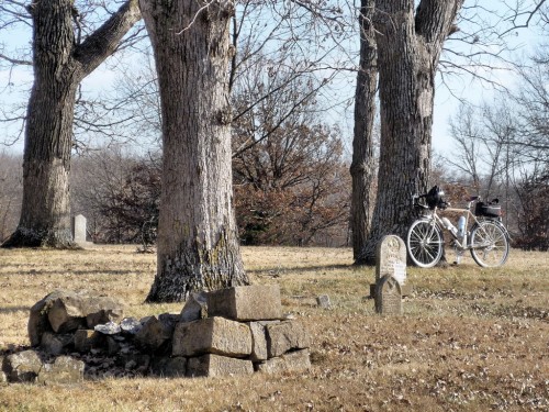 Many Indian graves are marked by piles of native stone.
Note: Most of the historical descriptions here are courtesy of the Franklin County Historical Society, which offers driving tours of Franklin County.
Randy, just found your site and spent a good deal of time looking around today. It combines some of my top aspects of cycling: gravel, Surly LHTs, prairies, and most importantly adventure. I don’t have near as much available here in Louisville, but I enjoy seeking out the mixed-terrain rides. Thanks.
[…] a trading post just south of the Marais des Cygnes, right where downtown Ottawa is today. On an earlier ramble, I visited the hotel he built northeast of […]
Great site! You wouldn’t happen to know if this photo is the Chippewa Indian Burial in Franklin county SE of Ottawa?
http://i1180.photobucket.com/albums/x404/jgrooms64/KC%20Area%20Photo%20Tag%20Adventurerider/P1000876.jpg
Thanks,
James
James, that is the Chippewa Cemetery, which is located a couple miles due west of Ottawa. GPS coordinates 38.591248,-95.365019