For Tuesday’s ride, I drove to Berryville, Arkansas and rode a loop toward the northeast. The route was similar to one I’d done in 2007. In fact, I immediately got off-track by following the old route from memory, rather than the new route map I’d drawn up.
I was a few miles down the road by the time I realized my error, so I just decided to keep on going — eventually I’d cross the planned route, and proceed from there.
The route took me northeast on Highway 21. Back in 2007, I’d found this to be a pleasant, low-traffic road, but on this day, the traffic was heavier, and far less pleasant. Perhaps I just hit it on a bad day (or a good day in ’07), but on this day it was bad enough that I wanted to escape it as soon as possible.
Problem was, my map wasn’t of sufficient resolution to be of much help. It only showed main roads, not gravel roads. I had the auto GPS with me, but it proved only marginally useful. It could show me where I was, but as soon as I tried to zoom out to get a wider perspective, I could no longer see enough detail.
All the roads were numbered, but the numbering scheme seemed somewhat random. Or at least I couldn’t make enough sense of it to be of much help.
Eventually, I crossed a road that was on my route map. Not a road on my route, but one that crossed it. Good enough. I got off the highway and did a few-mile detour until I got back on-route. From there, it was all pretty easy, route-wise.
The route took me near the town of Oak Grove, and through the non-existent burg of Yokum, then up a scenic, hilly paved road to Highway 311. This was a part of the route I was familiar with from three years ago, and not much had changed; most things still looked the same.
After leaving the highway at the town of Farwell, I was onto gravel again. I stayed on-route for a few miles, then changed things up on the fly, cutting short a loop, passing through the town of Green Forest, then heading west. I wanted to get back to Eureka Springs by 5:30pm for a ride at the local bike shop, and time was getting short.
The rest of the ride was uneventful, except for a good climb headed west back into Berryville. I remembered this from ’07, as a really difficult road. This time, it wasn’t too bad. There was almost no traffic on this nice paved road, which was great.
After getting back to the truck and driving to Eureka Springs, I found the bike shop closed. I waited around for a bit, but no one showed up. So eventually I just did a quick spin around the town.
Eureka Springs is a really hilly town (it calls itself “Little Switzerland”, if that gives you any idea), and getting around on the narrow streets is really pretty difficult by car. By bike, it’s really fun. There wasn’t much traffic, and what traffic there was moved very slowly (the speed limit’s 15 MPH in most of the town). I really enjoyed this little excursion.
(By the way, I wrote more about this at Kansas Cyclist: Eureka Springs: Naturally Bicycle Friendly.)
Some pics from the day:
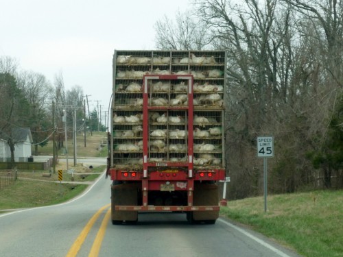
A truckload of chickens headed off to the Tyson plant. There’s a lot of large-scale chicken farms in this area, and they all sport “Tyson” signs. Not sure if that means they’re owned by Tyson in some way, or just under contract to Tyson.
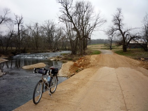
A low-water crossing of Yocum Creek near Yocum, Arkansas. This is a paved road; that gravel section is where the road must have washed out during flooding.
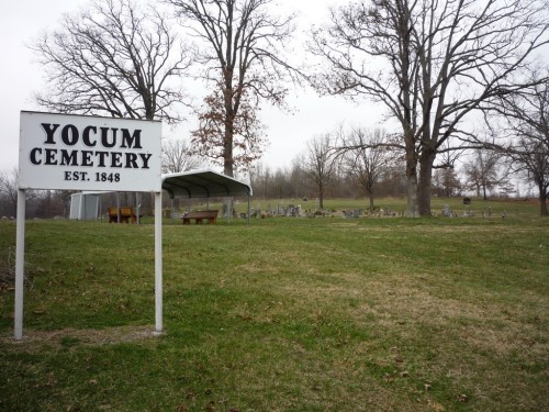
Yocum Cemetery near Yocum, Arkansas.
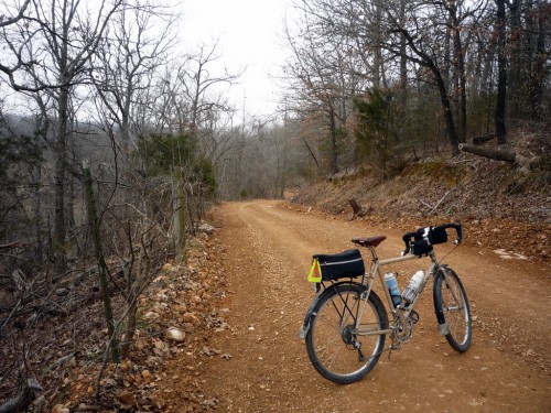
A twisty gravel road near Farwell, Arkansas.
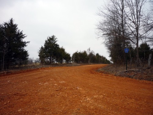
An Arkansas red dirt road. Nearly all the gravel roads in the area have a reddish tint, but this one was really bright!
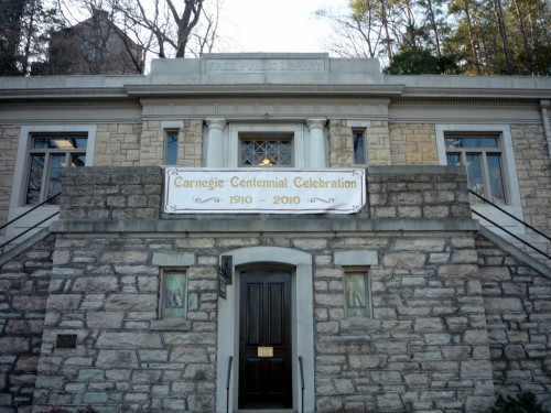
The Eureka Springs Carnegie Public Library is one of four Arkansas library buildings built with funding by Andrew Carnegie, one of hundreds of such institutions created with help from the wealthy philanthropist in the early years of the 20th century. This library was started in 1910 and finished in 1912. This beautiful Classical Revival-style building was constructed of locally quarried stone, and is listed on the National Register of Historic Places.
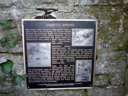
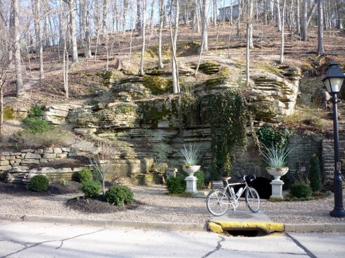
As you might expect, the city of Eureka Springs takes its name from springs that flow from the mountainsides in the area. Grotto Spring is so because it flows from a small cave (or grotto). Cement steps lead down into the grotto, and there are stone benches against the walls where you can sit and enjoy the cool quiet.
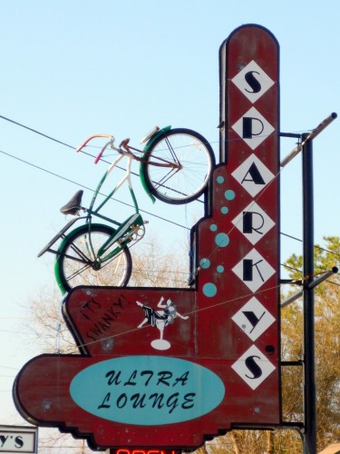
Sparky’s Ultra Lounge in Eureka Springs — “It’s Swanky!” according to the sign…
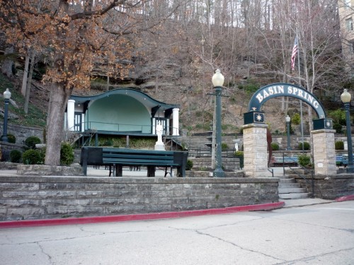
Basin Spring is the focal point in this city of springs. It’s located on Spring Street next to the historic Basin Park Hotel, and its waters were once touted as having curative properties. During the Civil War, a hospital was established nearby, and waters from Basin Spring were used to treat patients. On weekends and holidays, the bandstand built into the hillside is used for live music, concerts, and festivals.
Here’s the route map for the Green Forest Loop:
The Eureka Springs loop, I’ll leave to your imagination…
